
Bucks County Museum Map
Map of Bucks County Museum - Here is a location map for Bucks County Museum in Aylesbury, Buckinghamshire UK.
Map of Bucks County Museum Aylesbury
Bucks County Museum Map: Above you can view a map of Bucks County Museum located in Church Street, Aylesbury, Buckinghamshire. The museum was founded in the mid 19th Century, it had a £4 million makeover in 1995, the Roald Dahl Children's Gallery opened in 1996.
Visible on this Bucks County Museum map are: Wilkins Solicitors, Aylesbury Town Council Offices, Southcourt Walton Court Community Project, Temple Street Wine Bar, the Queens Head, the Victoria Club, Coral Bookmakers, Kingsbury Square, Fever & Cirque, the Coffee Tree, the Rockwood, Yellow Parrot, Money Shop, Nail Envi, Falck Fire Consulting, Pebble Lane, Church Street, St Mary's Square, Parson's Fee, George Street and more.
Zoom out for a wider view of the area around the Buckinghamshire County Museum. Click on the small box (bottom right) for a satellite view of Bucks County Museum in Aylesbury.
Address: Buckinghamshire County Museum, Church Street, Aylesbury, Buckinghamshire, HP20 2QP. Telephone number: 01296 331441. Sat Nav postcode: HP20 2QP.
For the Bucks County Museum opening times click here: OPENING TIMES
For all the best information on the museum visit the official website here: BUCKS COUNTY MUSEUM
Google Street View of Bucks County Museum Aylesbury
Above you can see a Bucks County Museum street view (Google), showing the museum in Church Street, looking towards St Mary's Church and St Mary's Square.
Photos of Aylesbury - Bucks County Museum in Church Street
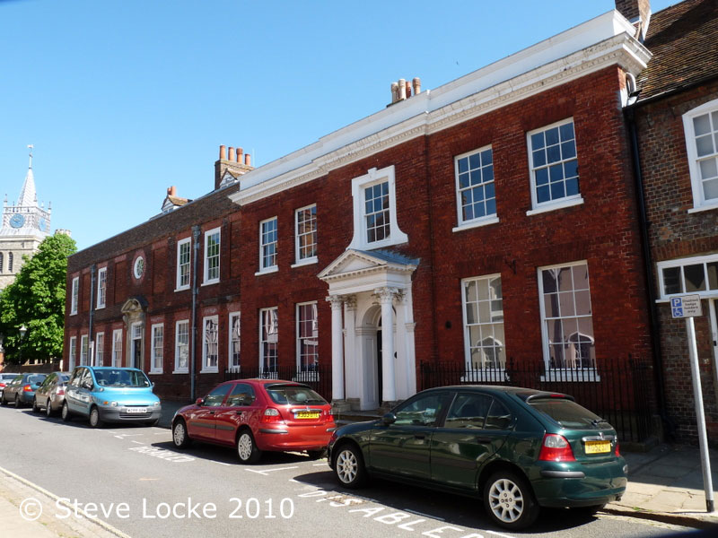
This image of the Buckinghamshire County Museum was taken in 2010.
More Aylesbury Maps:
>>>>> BACK HOME
Buckinghamshire County Museum Map - Buckinghamshire County Museum Address - Opening Times