
Stoke Mandeville Combined School Map
Map of Stoke Mandeville Combined School - Here is a location map for Stoke Mandeville Combined School near Aylesbury, Buckinghamshire UK.
Map of Stoke Mandeville Combined School Aylesbury
Stoke Mandeville Combined School Map: Above you can view a map of Stoke Mandeville Combined School located in Lower Road close to Aylesbury, Buckinghamshire.
Visible on this Stoke Mandeville Combined School map are: St Mary the Virgin Church, Oak Tree House, Malt House Farm, Urbane Hairdressers, Lower Road, Marsh Lane, Chestnut Way, Risborough ROad, Swallow Lane and more.
Use the zoom out feature for a wider view of the area surrounding Stoke Mandeville School. Click on the small box (bottom right) for a satellite view of Stoke Mandeville Combined School, Aylesbury.
Check on the Stoke Mandeville Combined School term dates here: TERM DATES
View the Ofsted Report for Stoke Mandeville School here: OFSTED REPORT
Address: Stoke Mandeville Combined School, Lower Road, Stoke Mandeville, Aylesbury, Buckinghamshire, HP22 5XA. Telephone number: 01296 612371.
Google Street View of Stoke Mandeville Combined School Aylesbury
Above you can see a Stoke Mandeville Combined School street view (Google), showing the school from Lower Road across the green.
Photos of Aylesbury - Stoke Mandeville Combined School
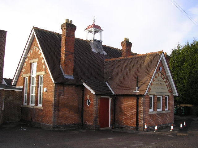
This photo of Stoke Mandeville Combined School was taken in 2010.
More Aylesbury Maps:
- The Woolpack
- Hospital Map
- Stadium Map
- Stoke Mandeville
- Aylesbury Schools
- Weston Turville C of E School
The official website for Stoke Mandeville Combined School can be found HERE
>>>>> BACK HOME
Stoke Mandeville School Map - Stoke Mandeville School Term Dates - Stoke Mandeville School Ofsted Report