
Aylesbury Library Map
Map of Aylesbury Library - Here is a location map for Aylesbury Library in Buckinghamshire UK.
Map of Aylesbury Library Buckinghamshire
Aylesbury Library Map: Above you can view a map of Aylesbury Library located in Walton Street, Aylesbury, Buckinghamshire.
Visible on this Aylesbury Library map are: Friars Square Shopping Centre, Metro Bank, Mix 96, Buckinghamshire County Council Offices, Aylesbury Bus Station, Nandos, The Bell (Wetherspoons), Barclays Bank, Halifax Building Society, Top Nails, Moss Bros, Odeon Cinema, the White Hart, Silver Street, Bourbon Street, Rickford's Hill, Station Way and more.
Zoom out for a wider view of the area around Aylesbury Library. Click on the small box (bottom right) for a satellite view of Aylesbury Library in Buckinghamshire.
Address: Aylesbury Library, Walton Street, Aylesbury, Buckinghamshire, HP20 1UU. Telephone number: 01296 382415.
You can get Aylesbury Library opening times and other useful information HERE
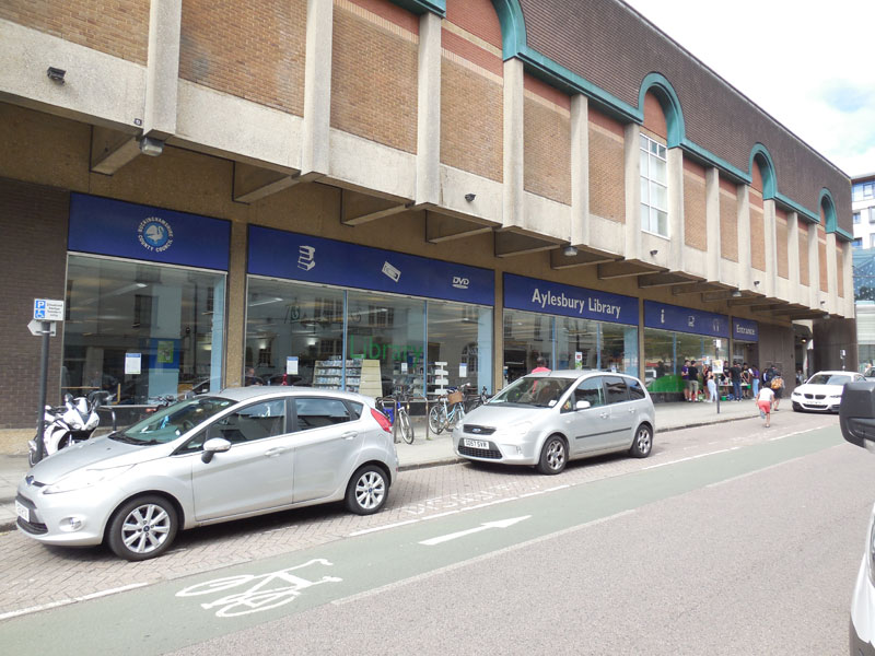
Google Street View of Aylesbury Library Buckinghamshire
Above you can see an Aylesbury Library street view (Google), showing the front of the building in Walton Street.
More Aylesbury Maps:
>>>>> BACK HOME
Aylesbury Library Opening Times - Address - Telephone Number - Aylesbury LIbrary Street View